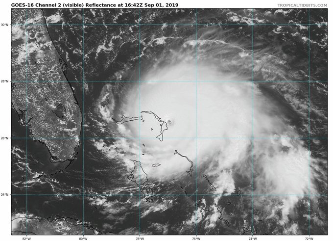
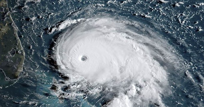
category 5 Hurricane Dorian hit the Bahamas Sunday—eliciting a slew of urgent public safety warnings, concerns about what’s in store for the Southeastern coast of the United States next week, and impassioned demands for ambitious government action to combat the global climate emergency.
Dorian made landfall at Elbow Cay, Abacos in the Bahamas early Sunday afternoon with maximum sustained winds of 185 mph and gusts over 220 mph, according to the U.S. National Hurricane Center. The eye of the hurricane made a second landfall on Great Abaco Island near Marsh Harbor later in the afternoon, with the same sustained windspeed. The center noted in an update on Twitter that “this is tied for the strongest Atlantic hurricane landfall on record with the 1935 Labor Day hurricane.”
Acknowledging Dorian’s significant windspeed Sunday, meteorologist and science writer Eric Holthaus tweeted, “This is a historic hurricane, and the damage in the Bahamas will be absolute.”
In a series of tweets Sunday, Bill McKibben, co-founder of the environmental advocacy group 350.org, pointed out that this is the fourth consecutive year that the Atlantic has seen a category 5 hurricane and wrote that “people are going to need to rally to the relief of what must be devastated islands.”
#Dorian is now one of the five strongest storms ever recorded in the Atlantic. And it's the 4th year in a row with a Category 5 storm, again breaking a record. #hotnewworldweather.com/storms/hurrica…
As #Dorian crashed into the Bahamas, its winds were 185 mph gusting to 220 mph, making it the strongest landfalling Atlantic hurricane ever recorded. People are going to need to rally to the relief of what must be devastated islandswunderground.com/cat6/Historic-…
The Weather Channel, which McKibben cited, explained that “category 5 hurricanes are rare and have maximum sustained winds 157 mph or greater. They can unleash devastating winds and catastrophic storm surge when they strike land.”
The National Hurricane Center continued to issue advisories about Dorian’s severity for residents of the Bahamas throughout the afternoon Sunday. Warning of “storm surge 18 to 23 feet above normal tide levels with higher destructive wave,” the center said in one update: “This is a life-threatening situation. Residents in the Abacos should stay in their shelter. Do not venture out into the eye if it passes over your location.”
Videos of conditions in the Bahamas began circulating online Sunday afternoon—along with warnings from experts that such devastation from natural disasters will continue to worsen as long as humanity continues to fuel the global climate crisis with activities that produce planet-heating emissions:
#Dorian is near perfect from a meteorological perspective, horrific from a threat perspective. And undoubtedly fueled by bathtub-warm sea surface temperatures tied to human-caused climate change. twitter.com/drshepherd2013…
BACKGROUNDER: Dorian moved through very warm ocean waters (86°F/30°C) this week, meaning there was plenty of energy to fuel its intensification. Full climate change context here: bit.ly/2ZAQE4t twitter.com/ClimateSignals…
Bahamas “Prime Minister Hubert Minnis said Saturday that 73,000 residents and 21,000 homes would be affected by the storm,” The New York Times reported.


